Spatial risk analysis is an exciting
new field concerned with mapping and evaluating the spatial predictors
of risk. These may be related to topography or climate,
or to manmade structures or communities. They can also
describe aspects of human behaviour and they often have important
temporal components.
Spatial risk analysis has been applied extensively to evaluate
the spread of emerging pests and diseases and other ecological
risks. It has also been used to evaluate the impacts associated
with climate change, and to optimise market research and other
spatially dependent business applications.
Spatial Simulation Modelling
Spatial simulation modelling is an important
extension of spatial analysis, used to study systems or problems
that are difficult to replicate using experiments.
Broadleaf Spatial Risk
Analysis and Modelling Services
We can help you to:
- Incorporate spatial elements into existing risk management
plans;
- Use spatial risk analysis or modelling to better understand
the threats and opportunities your organisation faces; and
- Develop in-house skills in spatial
analysis or modelling, so your organisation can stay on top of
these exciting fields.
We also offer dynamic facilitation and
powerful technical report writing capabilities.

Click on
the image below to return to the What We Do section of our website.

|
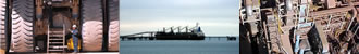
Broadleaf has specific expertise in spatial simulation modelling,
including a lead role in an ambitious collaborative project that
will see the development of a spatial simulation model for urban
pandemic influenza, and to test the effectiveness of Australia's
response strategies.
Please visit the AUSFLU web page for more information.
Our partners in this work, which is funded by the Australian
Biosecurity Cooperative Research Centre, are
- the Australian
Government Department of Agriculture, Fisheries and Forestry,
- the University of Melbourne
- and Curtin
University of Technology.
Click on any of the images on the left for the corresponding website.
Click on this link for a recent newspaper article about the project which will use Tamworth as a test site.
TRAINING
Click on the image below to download a PDF
containing details of a recent course led by Broadleaf Associate
Director Sam Beckett: Spatial Simulation Modelling for Animal
and Publich Health.
Click on the image below to return to contact
Broadleaf and learn more about how we can help you with spatial
risk analysis and modelling.

|